Now Offering Construction Layout Services | (737) 762-6440
ADVANTAGES for SURVEYORS & ENGINEERS
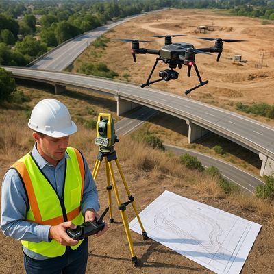
Survey-Grade Precision. Engineering Insight. Reliable Results.
At SkyMap Technologies, we empower surveyors and engineers with aerial LiDAR, photogrammetry, and GNSS-integrated mapping solutions that redefine efficiency, accuracy, and confidence in project data.
Whether for topographic surveys, site design, infrastructure layout, or as-built documentation, SkyMap delivers survey-grade, engineering-ready datasets that streamline workflows, enhance safety, and reduce field time—without compromising precision.
SURVEY-GRADE ACCURACY YOU CAN RELY ON
Precision Data Built for Professional Standards
SkyMap’s aerial workflows are designed to meet the accuracy expectations of licensed surveyors and design engineers alike.
By integrating survey-grade LiDAR, GNSS ground control, and aerial photogrammetry, we achieve centimeter-level accuracy suitable for engineering design and legal mapping applications.
Our precision workflow includes:
- Drone-based LiDAR acquisition with dense point cloud generation
- RTK/PPK GNSS ground control verification
- Vertical and horizontal alignment to project benchmarks
- Post-processed QA/QC accuracy reports
The result: verified, survey-grade accuracy that forms a reliable foundation for everything from subdivision layout to infrastructure design.
FASTER DATA COLLECTION AND PROJECT TURNAROUND
Efficiency That Saves Time and Expands Capacity
Traditional surveying and field data collection can be time-intensive—especially on large, complex, or obstructed sites.
SkyMap’s drone-based aerial mapping captures millions of elevation and image points in minutes, providing comprehensive datasets ready for use in CAD and GIS environments within days, not weeks.
Advantages include:
- Reduced field time and site visits
- Rapid project mobilization and turnaround
- Fewer access and weather delays
- Expanded capacity for multiple concurrent projects
SkyMap allows your team to take on more work, meet deadlines faster, and maintain high accuracy standards—all while reducing the strain on field crews.
SAFETY AND ACCESSIBILITY IN CHALLENGING CONDITIONS
Safer Data Collection, Anywhere You Work
SkyMap’s aerial systems collect high-quality data over difficult or hazardous terrain, minimizing risk to survey and engineering personnel.
Whether it’s steep slopes, active construction zones, quarries, or restricted areas, we capture accurate mapping data safely from above.
Key benefits:
- No need for field crews in dangerous or obstructed areas
- Reduced exposure to heat, wildlife, and equipment hazards
- No disruption to active job sites or infrastructure operations
- Improved data consistency in limited-access environments
Our approach keeps your teams safe while providing consistent, complete, and verifiable data coverage.
SEAMLESS INTEGRATION INTO CAD, GIS, AND BIM WORKFLOWS
Ready-to-Use Data That Fits Your Design Environment
SkyMap delivers fully processed, georeferenced datasets compatible with all major surveying, civil design, and GIS software platforms.
Our deliverables are optimized for direct import into Civil 3D, MicroStation, ArcGIS, TBC, Revit, and InfraWorks—eliminating the need for conversions or reformatting.
Deliverables include:
- Classified LiDAR point clouds (LAS/LAZ)
- Digital Terrain & Surface Models (DTM/DSM)
- Topographic contour maps and breaklines
- Orthomosaics and high-resolution imagery overlays
- Planimetric and volumetric mapping
- CAD-, GIS-, and BIM-ready formats (DWG, DXF, SHP, GeoTIFF)
SkyMap’s deliverables are engineer-verified, survey-ready, and quality-controlled—ensuring you can design and document with complete confidence.
INCREASED PRODUCTIVITY WITHOUT CAPITAL INVESTMENT
Advanced Aerial Technology — Zero Overhead for Your Firm
By partnering with SkyMap, surveyors and engineers gain access to enterprise-grade LiDAR and imaging systems without the cost of ownership or specialized training.
We handle the flight operations, data processing, and quality assurance—so your team can focus on design, analysis, and professional oversight.
Benefits include:
- No equipment investment or maintenance burden
- Access to the latest LiDAR and photogrammetry technology
- Rapid scalability for large or multi-site projects
- Reliable partnership for repeat work and long-term growth
SkyMap acts as your aerial mapping division, delivering data with the same precision and professionalism your clients expect from your firm.
COLLABORATION AND SUPPORT FROM INDUSTRY PROFESSIONALS
Aerial Mapping Backed by Real Surveying & Engineering Experience
Unlike general drone operators, SkyMap Technologies was founded by professionals with decades of hands-on experience in surveying, land development, and construction.
We understand your workflows, deliverable requirements, and accuracy standards—and we tailor every project accordingly.
Our collaboration process includes:
- Pre-project coordination for control networks and accuracy specifications
- Custom deliverable organization and file structuring
- On-demand consultation with SkyMap’s technical experts
- Texas-based support and rapid communication throughout every phase
SkyMap doesn’t just deliver data — we deliver reliability, partnership, and professional-grade precision that adds measurable value to your work.
ACCURACY, SAFETY, AND SPEED — ALL IN ONE SOLUTION
Aerial Data That Engineers and Surveyors Can Build On
With survey-grade LiDAR, precision GNSS control, and high-resolution imagery, SkyMap bridges the gap between traditional field surveying and modern aerial mapping.
Our deliverables support the full project lifecycle — from preliminary design and feasibility studies to construction staking and as-built verification.
When you need accurate, defensible, and time-efficient mapping data—SkyMap Technologies delivers clarity you can design, build, and certify from.
ELEVATE YOUR SURVEYING & ENGINEERING PRACTICE WITH SKYMAP TECHNOLOGIES
📍 Mapping Across Texas
🌐 www.skymaptechnologies.com
📧 nick@skymaptechnologies.com
📞 737-762-6440
COMMERCIAL & RESIDENTIAL - DEVELOPMENT & CONSTRUCTION

Accurate Data. Smarter Planning. Faster Buildout.
At SkyMap Technologies, we provide developers, builders, and construction professionals with survey-grade aerial LiDAR, photogrammetry, and ultra high-resolution imaging that transforms complex job sites into measurable digital environments.
From pre-construction planning to post-construction as-builts, SkyMap delivers precise, reliable data that supports every phase of commercial and residential development—helping your teams build smarter, faster, and with confidence.
PRECISE SITE ANALYSIS AND PLANNING
Accurate Ground Data Before Breaking Ground
SkyMap’s aerial LiDAR and photogrammetry systems generate detailed topographic and surface models that give developers and engineers a true understanding of site conditions before construction begins.
By identifying natural features, grading needs, and drainage patterns early, you reduce costly rework and design revisions.
Applications include:
- Feasibility and site selection mapping
- Grading and earthwork volume analysis
- Hydrology and drainage planning
- Environmental and vegetation assessment
- Pre-design base mapping for civil layout
With centimeter-level accuracy, SkyMap provides survey-grade terrain data that ensures your designs are based on verified, real-world conditions.
EFFICIENT CONSTRUCTION PROGRESS MONITORING
Track Progress. Manage Performance. Validate Work.
SkyMap’s drone-based aerial mapping captures consistent, time-stamped imagery and elevation data throughout construction.
This enables progress tracking, cut/fill verification, and work quantity validation—keeping contractors, project managers, and owners aligned at every stage.
Key advantages:
- Weekly, biweekly, or monthly progress flights
- Orthomosaics for visual progress documentation
- Volume and cut/fill analysis for grading validation
- 3D surface comparisons for design conformance
- Change detection and reporting for stakeholder visibility
Our data helps you maintain accountability, reduce disputes, and confirm performance against design specs.
ENHANCED SAFETY AND SITE ACCESS
Safer Inspections and Broader Coverage
SkyMap’s aerial systems safely capture site data from above—covering active, hazardous, or restricted areas without interrupting operations or putting personnel at risk.
We help you monitor safety compliance, logistics, and site conditions from a single, comprehensive visual perspective.
Advantages include:
- Reduced foot traffic and field exposure
- No disruption to heavy equipment or active work areas
- Aerial documentation of safety zones and site layout
- Accurate measurements without physical access
By leveraging aerial mapping, you maintain a safer, more informed job site—and a record of site conditions at every stage.
ACCURATE AS-BUILT AND POST-CONSTRUCTION DOCUMENTATION
Verify and Record with Confidence
Upon project completion, SkyMap provides high-resolution as-built mapping and 3D modeling that accurately documents final site conditions.
This data is ideal for record drawings, owner deliverables, warranty packages, and future expansion planning.
Deliverables include:
- As-built LiDAR point clouds and 3D surface models
- Digital Terrain and Surface Models (DTM/DSM)
- Orthorectified aerial imagery for record mapping
- Planimetric feature extraction (curbs, roads, utilities)
- Contours and elevation reports for final grading certification
SkyMap’s post-construction data ensures your projects are properly documented, compliant, and ready for turnover or permitting.
REDUCE COSTS AND DELAYS THROUGH BETTER DATA
Actionable Information That Improves Efficiency
Accurate, timely aerial data reduces uncertainty, helps coordinate contractors, and minimizes costly rework or delays.
By replacing multiple site visits with a single aerial capture, you can make informed decisions faster—keeping your project on schedule and within budget.
Benefits include:
- Early detection of grading and drainage issues
- Verification of subcontractor quantities
- Improved scheduling and logistics planning
- Minimized survey rework and mobilization costs
- Streamlined communication with design teams and owners
SkyMap empowers developers and builders with aerial intelligence that drives smarter project management and measurable savings.
DELIVERABLES THAT DRIVE DEVELOPMENT AND CONSTRUCTION SUCCESS
Accurate. Visual. Integration-Ready.
SkyMap provides deliverables formatted for direct use in engineering, design, and project management software—ensuring seamless collaboration between design, field, and office teams.
Deliverables include:
- Classified LiDAR point clouds (LAS/LAZ)
- Digital Terrain and Surface Models (DTM/DSM)
- High-resolution orthomosaics and aerial imagery
- Topographic and contour mapping
- Volume and cut/fill analysis reports
- CAD-, GIS-, and BIM-ready files (DWG, DXF, SHP, GeoTIFF)
- Cloud-hosted visual dashboards for remote access
Every dataset is survey-grade, quality-verified, and aligned with your project coordinate system—ready for immediate integration into design and construction workflows.
A PARTNER BUILT ON EXPERIENCE
Decades of Field Knowledge. Proven Technology.
With over 20 years of experience in surveying, construction, and land development, SkyMap Technologies understands the challenges faced by contractors and developers.
Our data solutions are built on the principles of precision, reliability, and communication—delivering results that construction professionals can trust from start to finish.
We work directly with developers, engineers, and general contractors to ensure every dataset is tailored to your scope, tolerances, and timelines—because when your data is right, your project is right.
ELEVATE YOUR DEVELOPMENT AND CONSTRUCTION PROJECTS WITH SKYMAP TECHNOLOGIES
📍 Mapping Across Texas
🌐 www.skymaptechnologies.com
📧 nick@skymaptechnologies.com
📞 737-762-6440
ADVANTAGES TO THE AGGREGATES & MINING INDUSTRY
Accurate Measurements. Safer Operations. Smarter Management.
At SkyMap Technologies, we help quarry and mining operators transform their sites into measurable, manageable digital assets.
Our drone-based LiDAR and photogrammetry mapping services deliver precise volumetric data, surface models, and progress monitoring that streamline production, reduce safety risks, and ensure operational efficiency across every phase of your operation.
ACCURATE INVENTORY AND VOLUME MANAGEMENT
Know What You Have — Instantly and Accurately
SkyMap’s aerial mapping technology provides exact measurements of stockpiles, excavation areas, and site changes.
Using survey-grade LiDAR and high-resolution imagery, we generate accurate volumetric reports that eliminate the guesswork in material tracking and resource management.
Applications include:
- Stockpile inventory and material volume analysis
- Extraction and production tracking
- Cut/fill and pit expansion measurement
- Overburden and backfill analysis
- Material flow and haul road planning
Our volumetric deliverables are validated against GNSS ground control, ensuring centimeter-level accuracy for audits, billing, and internal reporting.
INCREASED EFFICIENCY AND OPERATIONAL INSIGHT
Fast Data Collection with Minimal Disruption
Traditional ground-based measurement methods are time-consuming, labor-intensive, and often disruptive to active operations.
SkyMap’s drone-based data acquisition safely captures high-density topographic data and detailed imagery in a fraction of the time—without halting production.
Key advantages:
- Zero production downtime during mapping
- Faster data collection over large or hazardous areas
- Comprehensive, repeatable site models for time-series comparison
- Weekly, monthly, or quarterly mapping cycles for progress tracking
With SkyMap, operators can make real-time operational adjustments, optimize resource usage, and improve overall site management efficiency.
SAFETY THROUGH AERIAL OPERATIONS
Reduce Exposure. Increase Awareness.
Safety is critical in every mining and quarry environment.
SkyMap’s aerial workflows minimize the need for personnel to access unstable stockpiles, heavy equipment zones, or steep quarry walls—allowing your team to gather precise data safely from above.
Benefits include:
- Elimination of manual stockpile climbing and GPS walking
- Improved hazard identification through high-resolution imagery
- Accurate mapping of restricted or inaccessible areas
- Reduced field time and site exposure for staff
By prioritizing safety and precision, SkyMap helps your operations maintain compliance while reducing the likelihood of injury and error.
DETAILED SITE PLANNING AND DESIGN SUPPORT
Survey-Grade Data for Mine Planning and Expansion
Our aerial LiDAR and photogrammetry data provide a high-resolution digital twin of your entire operation—perfect for engineers and planners designing pit expansions, haul routes, and reclamation efforts.
Every dataset is georeferenced and compatible with your CAD and GIS software for seamless integration.
Applications include:
- Site development and mine expansion planning
- Reclamation mapping and restoration monitoring
- Drainage and runoff analysis
- Infrastructure and utility layout planning
- Erosion and slope stability studies
With detailed surface and terrain models, SkyMap ensures your plans are built on accurate, defensible data.
COST SAVINGS AND PERFORMANCE OPTIMIZATION
Data That Improves Profitability and Control
By replacing manual field surveys with fast, repeatable aerial mapping, SkyMap reduces costs while improving the precision and frequency of data collection.
This gives your management team real-time insight into production, performance, and yield.
Advantages include:
- Lower labor and equipment costs
- Reduced downtime for measurement and verification
- Better visibility of material movement and production trends
- More accurate reconciliation for billing and logistics
SkyMap’s accurate, repeatable datasets support better forecasting, budgeting, and accountability—helping you run a more profitable operation.
DELIVERABLES DESIGNED FOR INDUSTRIAL WORKFLOWS
Actionable Data in Every Format You Need
SkyMap provides a complete suite of deliverables tailored for aggregate and mining operations.
Each dataset is georeferenced, verified, and compatible with your existing engineering and planning software.
Deliverables include:
- 3D point clouds and surface models (LiDAR & photogrammetry)
- Digital Terrain and Surface Models (DTM/DSM)
- High-resolution orthomosaics for visual analysis
- Volume and inventory reports (cut/fill, stockpile, extraction)
- Time-series change detection and trend mapping
- CAD- and GIS-ready data (DWG, DXF, SHP, GeoTIFF)
- Cloud-based dashboards for progress visualization
Every SkyMap deliverable is survey-grade, quality-assured, and formatted for immediate integration into your design, planning, or reporting workflow.
EXPERIENCE YOU CAN TRUST
Two Decades of Field Expertise. Industrial-Grade Results.
With over 20 years of experience in surveying, land development, and construction, SkyMap Technologies brings a deep understanding of industrial site operations to every mapping mission.
Our team provides the precision, reliability, and responsiveness that aggregates and mining operations demand.
We partner with operators, engineers, and production managers to ensure every dataset meets safety, regulatory, and operational accuracy standards—because in your industry, data isn’t just valuable; it’s critical.
ELEVATE YOUR AGGREGATES & MINING OPERATIONS WITH SKYMAP TECHNOLOGIES
📍 Mapping Across Texas
🌐 www.skymaptechnologies.com
📧 nick@skymaptechnologies.com
📞 737-762-6440
ADVANTAGES TO THE UTILITY & ENERGY SECTORS

Powerful Insight. Preventative Maintenance. Proven Accuracy.
At SkyMap Technologies, we deliver aerial LiDAR, thermal, multispectral, and ultra high-resolution RGB mapping solutions built specifically for the utility and energy industries.
Our data-driven approach gives operators the intelligence they need to maintain grid reliability, inspect assets safely, and optimize performance—all with survey-grade precision and efficiency.
COMPREHENSIVE ASSET VISIBILITY AND CONDITION MAPPING
See More. Understand More. Operate Smarter.
SkyMap’s multi-sensor aerial systems capture detailed 3D and spectral data across extensive utility corridors and energy infrastructure.
We deliver a complete digital perspective of your assets—allowing engineers, inspectors, and maintenance teams to identify problems before they cause disruptions.
Applications include:
- Transmission and distribution line inspection
- Pipeline and right-of-way monitoring
- Substation and transformer inspections
- Solar array and wind farm analysis
- Thermal performance evaluation and anomaly detection
- Encroachment, vegetation, and clearance mapping
With every flight, SkyMap delivers precise, actionable insight to help you maintain network integrity and operational resilience.
MULTI-SENSOR ACCURACY AND ADVANCED ANALYTICS
LiDAR + Thermal + Multispectral + RGB — Unified Data for Smarter Operations
Our synchronized multi-sensor platforms collect data across multiple spectrums, giving utility and energy operators a complete understanding of structural, environmental, and thermal conditions.
Capabilities include:
- LiDAR scanning for elevation, clearance, and 3D structure modeling
- Ultra high-resolution RGB imagery for detailed visual inspection
- Thermal imaging for detecting hotspots, overloads, and energy loss
- Multispectral imaging for vegetation health and corrosion monitoring
- GNSS and PPK/RTK control for survey-grade accuracy and repeatability
Every dataset is georeferenced, calibrated, and quality-assured, providing operators with the precision necessary for engineering analysis, maintenance planning, and compliance documentation.
SAFER, FASTER, AND MORE EFFICIENT INSPECTIONS
Reduce Risk. Save Time. Maintain Reliability.
SkyMap’s aerial inspection workflows replace manual climbing and helicopter flyovers with fast, repeatable drone-based mapping.
We help utilities and energy companies inspect more assets in less time—without outages or safety risks.
Key advantages include:
- No need for line shutdowns or direct contact
- Reduced inspection costs and field time
- Improved safety for maintenance crews
- Faster identification of faults and anomalies
- Repeatable mapping for time-based change analysis
By combining high-resolution imaging with LiDAR precision, SkyMap ensures your inspections are both comprehensive and cost-effective.
RELIABILITY BUILT ON EXPERIENCE AND TECHNOLOGY
Two Decades of Surveying and Industrial Insight
With over 20 years of experience in surveying, construction, and infrastructure development, SkyMap Technologies brings real-world understanding to technical operations.
We partner directly with utilities, energy producers, and engineering teams to deliver data that meets strict operational and regulatory requirements.
Our expertise ensures:
- Survey-grade accuracy and documentation
- Compliance with industry standards (FERC, DOT, OSHA, FAA)
- Reliable, repeatable results for long-term asset management
- Tailored deliverables for your specific workflow and software systems
SkyMap is not just a data provider—we are a trusted partner in your commitment to system reliability and operational excellence.
SUPPORTING THE ENERGY TRANSITION
Mapping the Future of Energy with Precision and Insight
As renewable energy continues to expand, SkyMap provides aerial mapping solutions that support design, monitoring, and maintenance across solar, wind, and transmission networks.
We help utilities and developers plan new installations, monitor performance, and ensure ongoing safety and efficiency.
Applications include:
- Solar array inspection (thermal and RGB)
- Wind turbine inspection and 3D modeling
- Substation layout and design mapping
- Vegetation encroachment and shading analysis
- Environmental and erosion impact monitoring
Our high-resolution datasets support sustainable energy development—ensuring new infrastructure is optimized for performance, safety, and longevity.
DELIVERABLES THAT DRIVE OPERATIONAL PERFORMANCE
Detailed. Actionable. Integration-Ready.
SkyMap provides a full suite of deliverables designed for utility, energy, and engineering workflows, formatted for compatibility with GIS, CAD, and asset management systems.
Deliverables include:
- 3D LiDAR point clouds and clearance models
- Thermal and multispectral anomaly maps
- High-resolution RGB orthomosaics
- Digital Terrain and Surface Models (DTM/DSM)
- Vegetation and encroachment classification layers
- Change detection and trend reports
- CAD-, GIS-, and BIM-ready exports (DWG, DXF, SHP, GeoTIFF)
- Web-based visualization and inspection dashboards
Each deliverable is precisely aligned, quality-verified, and formatted for direct integration into your asset management and engineering platforms.
ACCURACY THAT POWERS DECISIONS
Proactive Insight. Predictive Maintenance. Proven Results.
SkyMap’s data doesn’t just show what’s happening—it helps predict what’s next.
Our integrated analytics and consistent time-based mapping allow operators to track asset performance, identify degradation, and schedule maintenance proactively—reducing downtime and extending asset life.
By merging survey-grade LiDAR accuracy with thermal and multispectral intelligence, SkyMap provides a complete operational picture that supports smarter, safer, and more sustainable decision-making.
POWER YOUR OPERATIONS WITH SKYMAP TECHNOLOGIES
📍 Mapping Across Texas
🌐 www.skymaptechnologies.com
📧 nick@skymaptechnologies.com
📞 737-762-6440